A simple way to map landuse
Step1: download landcover classification data
There are lots of good quality landcover products, likes GlobeLand30.
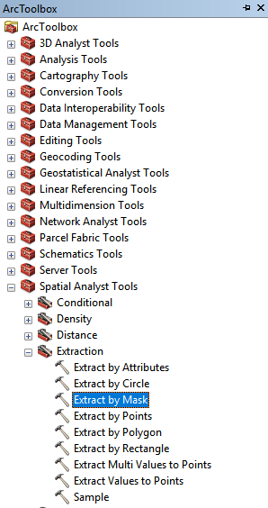
Step2: extract the area you are interested in
ArcToolBox -> Spactial Analyst Tools -> Extraction -> Extract by Mask
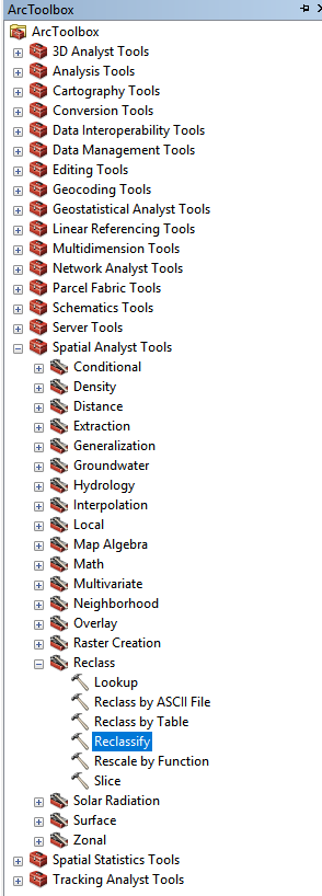
Step3: reclassify to reach the landuse
ArcToolBox -> Spactial Analyst Tools -> Reclass -> Reclassify
Step4: summarize area of same type
For a relative small area, the grid will be regarded as same cell size. In other words, every grid has same cell area. Then the sum of each type is the cell area multiplied by the count.
Select the target layer -> Open Attribute Table -> Add Field -> Set Name and Type as needed -> Right-click at the new field -> Field Calculator -> Tyep [Count] * 300 * 300 (300 is the cell side length)
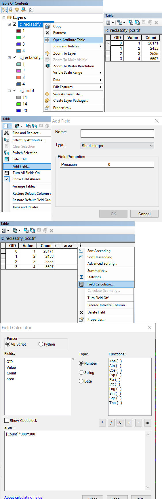
Note the coordinate system. In my opinion, it’s better to set as a local projected coordinate system.
Share on: